

Fri, Apr 19, 2024
 22.12°C Kathmandu
Opinion
At your own risk
Earthquake and other disaster warnings could not have come at a worse time for Nepal
bookmark
Navin Singh Khadka
Published at : February 5, 2016
Updated at : February 5, 2016 08:51
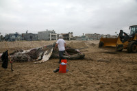
Perhaps there is no one this write-up could hold accountable or could seek responsible answers from. Such is the political vacuum in Nepal. Otherwise, for instance, the “build back better” slogan would not have remained empty words for the earthquake survivors even after 10 months of the disaster.
If this is the treatment suffering citizens get from the state, you can imagine how ignored people might be when it comes to preventive measures. Disaster risk reduction is an area donors are so much into these days—at least on paper. The government too has a separate unit for that under the Home Ministry. But how much of work has actually been done is anybody’s guess.
Preoccupied with pressing day-to-day issues as it is, the country could have
afforded to forget about disaster preparedness for now—only if there were no impending dangers.
Not yet over
One such risk is what scientists believe is an unfinished business of the 2015 April earthquake. They say that the major quake did not release all of the underground stress and has rather pushed some of it westwards.
Published in the journals Nature Geoscience and Science, the research shows that the quake had released only part of the pent-up pressure. It was built up by the locked state of the boundary between the Indian and Eurasian plates in this particular area.
“If the earthquake had ruptured all the way to the front of the Himalayas, it would have been a much larger earthquake,” one of the researchers Professor Jean-Philippe Avouac of the Cambridge University told the BBC. “But this earthquake did not generate a lot of high frequency waves, which
would have been devastating for the small buildings in Kathmandu. They could
withstand the earthquake because of the characteristics of the ‘pulse’ and its
relative smoothness.”
Scientists have warned that the expected shake may not be as gentle. “We don’t want to scare people, but it is important they are aware that they are living in a place where there is a lot of energy available.”
Another report published in Nature Geoscience five months later was more detailed. It said that the main fault did not rupture all the way to the surface as it stopped abruptly some 11 kilometres under Kathmandu on April 25 last year. “Our hypothesis is that the abrupt stop is because the main fault has been damaged and it was held up where it intersected with other smaller faults,” said one of the researchers John Elliott from the Oxford University. It has been asserted by the researchers that if the remaining rupture happens all the way to the surface in one go, it will be a quake similar to the April 25 scale but more damaging because it will be much shallower.
“The holding up of the damaged main fault will be temporary,” said Elliott. “These earthquakes tend to happen on the century timescale, but this barrier could be pushed through on a shorter timescale. Of course, our problem is that we are not able to predict when; we can never give a date,” he told the BBC.
Now that it is not the question of “if” but “when”, preparing for another big one is a no-brainer. People may be doing what they can from their level, some works from the central and local governments might be happening here and there as well. But this warrants a national level master plan. Something that is widely discussed, planned and implemented. Instead, the reconstruction works are disastrously delayed. And now we are hearing that there is a territorial fight between the National Reconstruction Authority and other government ministries.
Technological advancements
Meantime, technologies in the international arena are developing by leaps and bounds when it comes to dealing with natural disasters. Take for instance an initiative by NASA that can be crucial in the immediate aftermath of an earthquake.
Its Jet Propulsion Laboratory(JPL) has developed a way to make maps of natural disaster damage using remote sensing technology of satellites. What makes it pioneering is that it can show the damages even if the satellite images are taken at night or when the sky is cloudy. And guess what? The researchers of this new technology published the results in the journal Seismological Research Letters after studying Nepal’s April earthquake.
“Using software developed at JPL, the researchers produced damage proxy maps using COSMO-SkyMed and ALOS-2 data, respectively, covering an area near Kathmandu, Nepal,” NASA stated in its website.
“With COSMO-SkyMed data, the damage proxy maps found clear evidence of building collapses. The damage proxy maps from ALOS-2 data additionally detected devastating landslides impacting communities in the Langtang Valley, a popular Himalayan trekking destination.”
In yet another development, Europe began to roll out a data superhighway in orbit above the Earth beginning last week. What it basically does is gather pictures of the planet taken by other spacecraft and relay them to the ground.
“One benefit will be to put information on natural disasters, such as flooding and earthquakes, into the hands of emergency responders far faster than has previously been possible,” writes the BBC’s science correspondent Jonathan Amos. Such information will also be a key in terms of dealing with weather related disasters in the wake of dangerously changing climate.
How much can poor countries access these facilities may still be a question though. But it will be for the governments of such nations to strive to get as much benefit as possible for their populations.
That is where Nepal’s luck seems to be running out. With politics going nowhere, disaster related warnings continue to fall on deaf ears. And the real trouble is the end of political instability is simply not in sight—while the dangers of deadly disasters are.
Khadka is a BBC journalist based in London


Editor's Picks


E-PAPER | April 19, 2024
×